|
Shaw
Springs
 I spent three days
at Shaw Springs one night, in a van, NOT a caboose, kept awake all night by the
continuously racing "semi's" and eastbound trains. Don't they run trains
during the day anymore? Shaw Springs... the name conjures visions of Alice Springs,
in far off Australia. They're both semi-arid. There is just one house and a truck
stop restaurant at Shaw Springs. The trucks stop at night when the restaurant is
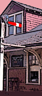
closed, and by the time it opens at 6 a.m., they are long gone. There is a "For
Sale" sign out front, little wonder. I spent three days
at Shaw Springs one night, in a van, NOT a caboose, kept awake all night by the
continuously racing "semi's" and eastbound trains. Don't they run trains
during the day anymore? Shaw Springs... the name conjures visions of Alice Springs,
in far off Australia. They're both semi-arid. There is just one house and a truck
stop restaurant at Shaw Springs. The trucks stop at night when the restaurant is
closed, and by the time it opens at 6 a.m., they are long gone. There is a "For
Sale" sign out front, little wonder.
Shaw Springs British Columbia lies in the Thompson River Canyon on Canadian
Pacific's main line between Vancouver and Calgary. There is a passing siding and a
private grade crossing, use at your own risk, and little else but sagebrush and pine
trees. However, Shaw Springs is near the center of one of Canada's best rail fanning
locations, the Thompson River Canyon between Lytton and Spences Bridge.
Canadian Pacific's Thompson Subdivision starts at Kamloops, mile zero, and
travelling westbound the mileposts increase to end at 121.5 in North Bend. (I'll
refer to directions as east and west but in fact the tracks physically run north
and south in some places due to the twisting route through the Thompson and Fraser
Canyons. Distance is still measured in miles on Canadian railways as they were
excused from converting to metric when that occurred several years ago.)
Spences Bridge lies at milepost 72.8 of CP's Thompson Subdivision while Lytton is
located 22 miles west at milepost 94.9. Between may be found some of the best
scenery locations along both of Canada's two major railways, Canadian National and
Canadian Pacific. Currently, due to the sharing arrangement between the railways,
westbound traffic runs on CN's line while eastbounds follow CP's route. (There are
exceptions.) CN's track is located on the west and north side of the river, CP on
the other. The Trans-Canada Highway stays to the east and south side of the river
between these two points. The canyon is narrow enough in several places to get a
good photo of trains on the opposite side of the river. At other locations the
highway is so far up the mountainside trains below are dwarfed by the scenery.
Beginning at Spences Bridge, travel west, there are several spots to visit. Because
there are so few places to stop along the highway I would suggest you drive the 22
miles both ways making a note of safe stopping places. In the summer months traffic
can be quite heavy and the trucks, oh the trucks, they do not want to slow down!
First, check out the Skoonka Tunnels on the CN, there is an access road near CP
milepost 78. Next you will find Shaw Springs located at CP milepost 79.3 which CP
calls Drynoch. The siding here is 7,380 feet long. The next interesting spot, we
call it Rattlesnake Hill, (We surprised a 3 foot long rattlesnake there last trip.
Correction, the snake wasn't half as surprised as we were!) is the junction of the
Nicomen Creek with the Thompson as the Thompson turns west. The highway follows the
Thompson just above the flood level protected by a concrete wall here. There are
possible photo sites until reaching the Jaws of Death Gorge around milepost 87 then
the highway climbs the mountain side as glimpses of the canyon and tracks below
catch your eye. If you stop at Kumsheen River Rafting near the top of the hill you
can find a place to park then walk towards the canyon for a view. The last good
photo opportunity lies just east of the Jade Springs store found a few miles before
reaching Lytton. There is a safe spot to pull over near the store.
These photos are from my latest trip to the Thompson Canyon, on 16 January 2001. It
went to sub-zero temperature during the night with a slight warming during daylight
hours. It is such a dry area there was little snow in evidence but the wind which
whistles down the canyon can cut right through you without warm weather clothing.
Now, if only it would snow, and I could be there immediatly after, and the sun
would shine brightly on the newly fallen snow, and the TOPs would be infrequent,
and the RTC would run street cars, and, and, and...
Associated Links
Canadian Pacific Railway
Canadian National Railways
© Copyright 2002 William C.
Slim
pacificcoast.net/~slim
|